
Department of Health and Disaster Management – Florida Department of Health (DOH)
 The State of Florida must be prepared to respond quickly and effectively on a 24-hour basis to developing events. All State agencies and volunteer organizations, that comprise the State Emergency Response Team, are grouped into 18 Emergency Support Functions (ESF) to carry out coordination and completion of assigned missions. These functions represent specific response activities that are common to all disasters. As the lead agency for Florida’s Emergency Support Function 8 (ESF 8 – Public Health & Medical), DOH coordinates development and maintenance of plans that are internal to the department, those used by partner organizations in the state’s public health and medical fields as well as by the public.
Identifying the problem
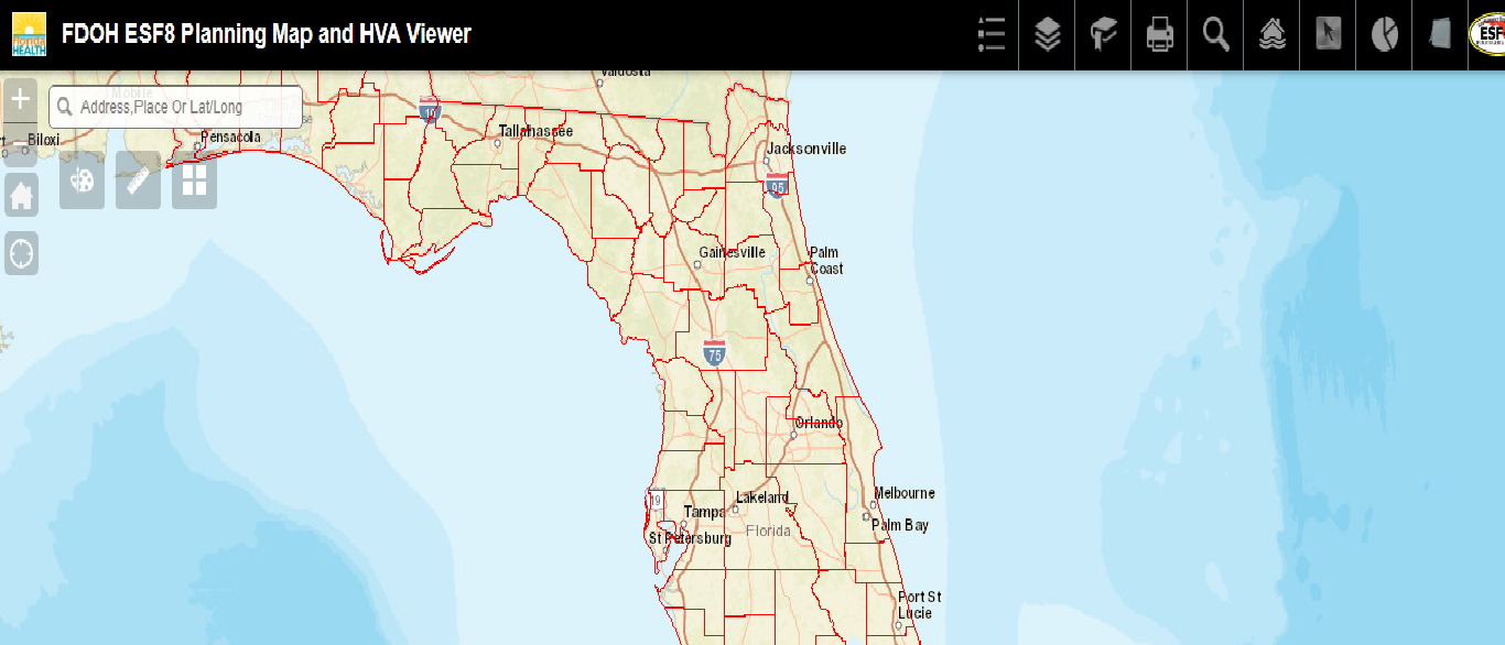
The ESF8 group required their assets, healthcare facilities, and environmental health facilities to be mapped in relation with vulnerabilities such as storm surge and floods. Furthermore, they had a need to see their event data on the map. The requirement was also to search and query these layers with a downloadable result set. This helped them to be prepared for an emergency response. The application was especially helpful during Hurricane Matthew in 2016. We fully expect this application to be useful during Hurricane Irma in 2017.
What technologies did we use to solve their issue?
ESRI ArcGIS Online, ArcGIS for Server & Web apps builder framework – ESRI JS API 3.16
What was the benefit of our technologies?
Benefits of the technology are:
- ArcGIS Server provides feature services that are maintained by DOH.
- The ArcGIS Online data content is latest.
- Configurable and customizable the base web apps builder framework and extending it provided clean UI and ESRI support for custom widget development.
- It can be easily updated to newest version of web apps builder.
Click here to see the application in action.
History of Jitendrudu Lacaraju
Jeetu has 13 years of experience in Geospatial applications in utilities, transportation, insurance & asset management domains.
His specialties include ESRI, ArcGIS suite, Open source Leaflet, Mapbox, and Carto. Enterprise applications development in .NET and Java stacks on web and mobile platforms.
At EPIC, Jitendrudu worked on projects such as the FL Dept of Health Web applications, Simplify i3, FL DOT – EDR, ROW applications and the FDACS – Roadmap to Living Healthy application.